

Maps and Railroads
Westmoreland Research explores military and civilian cartographic materials from the 1700s to the present. We also research ships plans and engineering, as well as Interstate Commerce Commission (ICC) railway Valuation Maps and Field Notes, for which we have state-of-the-art duplication capabilities.

ICC Railroad Valuation Records—Created by the Interstate Commerce Commission (ICC), this collection provides detailed documentation pertaining to the railroads of the United States from their beginning until the1960s. Most of these records were created during the period 1915 to 1920 by ICC and railroad employees who undertook a massive project to inventory almost every aspect of the existing railroad system in the U.S. The records are part of Record Group 134 and comprise approximately 11,000 cubic feet of maps, ledgers, field notes, engineering notes, etc.

Bar Harbor, Maine
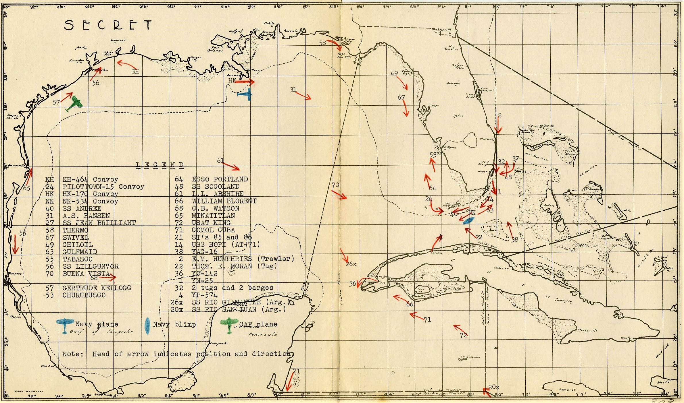
Office of the CNO vessel plot showing locations of merchant and naval vessels and deployed anti-submarine countermeasures in the Gulf of Mexico and Caribbean. (RG38)

Potomac River near Georgetown
Banner image, top: “Proposed Development of the Central Area West and East of the Capitol Washington D.C. 1941”